
Tasmania – a little island south of Melbourne, formerly known as Van Diemen’s Land. The Dutch explorer Abel Tasman had been the first to set foot on the island, which was later renamed to Tasmania in his honor. During my time in Melbourne I had always wanted to pay Van Diemen’s Land a visit but had to wait another couple of years until October 2012, when after a short stop-over in Melbourne I arrived in Hobart, the capital of Australia’s smallest state.
Hobart welcomed me with light rain which I was told is the common weather in Tasmania. I picked up my rental and headed straight downtown to City Central Backpackers where I had booked myself a dorm for the first two nights.
Hobart is a nice little town and home to almost half of Tasmania’s population, which counts only about half a million people.

The weather cleared up and got actually quite warm, so I spent my time visiting the Botanical Gardens and strolling along the streets. At the hostel I met Birgit, a German backpacker who was also eager to get out of the city and we decided to team up for a little road trip the next day.

About an hour north-east of Hobart is Richmond, a small town which is famous for its old stone bridge which was built around 1825 and is Australia’s oldest bridge still in use.

Not far from Richmond Bridge St John’s Catholic church sits on a hill. It was built in 1836, and is considered the oldest Roman Catholic church in Australia.


Apart from that there’s not much else to do or see and after a coffee we were back on the road towards Port Arthur on the Tasman Peninsular.

It is best known as Tasmania’s top tourist destination, showcasing its history as a convict settlement.

It is also infamous for one of the worlds deadliest shootings comitted by a single person: On 28 April 1996, the Port Arthur historic site was the location of a killing spree where 35 people were murdered and another 23 wounded. The perpetrator is currently serving 35 life sentences plus 1035 years without parole in the psychiatric wing of Risdon Prison in Hobart.

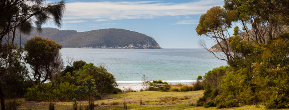
After dinner at White Beach and some further exploration of the peninsular it was getting a little too late in the evening to enter the open air museum, so I dropped Birgit off at a caravan park nearby and continued to a campsite at Fortescue Bay from where I wanted to start a two-day hike to Cape Hauy and Cape Pillar.
I started the walk in thick fog the next morning and reached Cape Hauy after only about two hours. The path resembled a highway rather than a wilderness experience, due to the “Three Capes Track” project by Parks & Wildlife Service. Not sure if I like the idea of creating wide, flat paths into remote areas so that any tourist in high-heels can walk them … but it was a nice walk anyway and on the way I made first contact with some young tiger snakes, one of three Tasmanian snakes. Luckily all of them are highly venomous and should better be avoided.

For rock climbers, Cape Hauy is known for two rock features, the Candlestick and Totem Pole. Both can only be climbed after a swim in the ocean and setting up a flying fox. I made do with some scrambling and whale watching.

From Cape Hauy a less developed track lead through forest across Mt. Fortescue and to Cape Pillar.

After a long day I finally reached a spot to pitch my tent next to the Perdition Ponds.

The view from the nearby cliffs was spectacular and the setting sun painted a warm red across the landscape.

The remaining walk to the cape was longer and tougher than expected but it rewarded me with more beautiful views of Tasman Island and the sourrounding seacliffs.

The walk back to the campsite wasn’t any less beautiful, through varied landscape and lots of spring flowers.

I picked up Birgit from the caravan park and we drove north towards Freycinet National Park. We had planned to take the scenic Wielangta Forest Road rather than the highway but somehow got lot multiple times. Somehow we managed to book accommodation at Bicheno Backpackers along the way (Optus coverage in Tasmania sucks!) and even saw a Tasmanian Devilon the road. Well, its rear features anyway.
